Editable and Interactive PowerPoint World Map
Easily use and edit these maps in your PowerPoint slides.
Provided as two presentations, the first is interactive and the second contains style examples and each contains 9 slides:


Get this map as a PowerPoint template
$99 | €69 | £59
Get thousands of maps in the ribbon
from $149 | €115 | £99
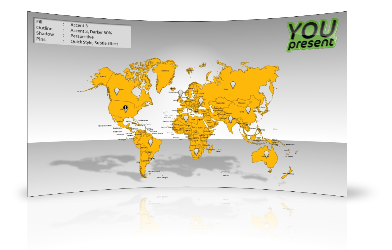
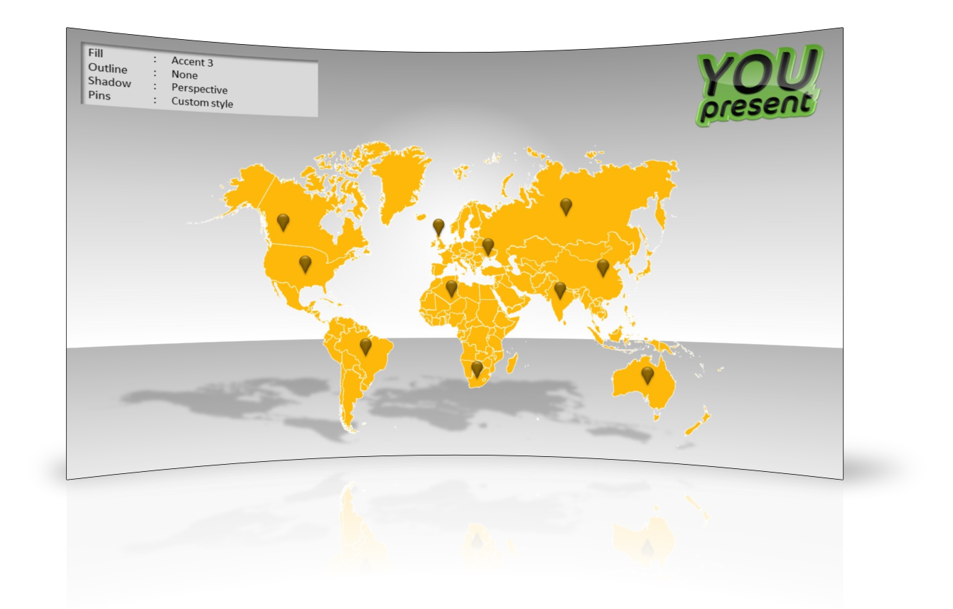
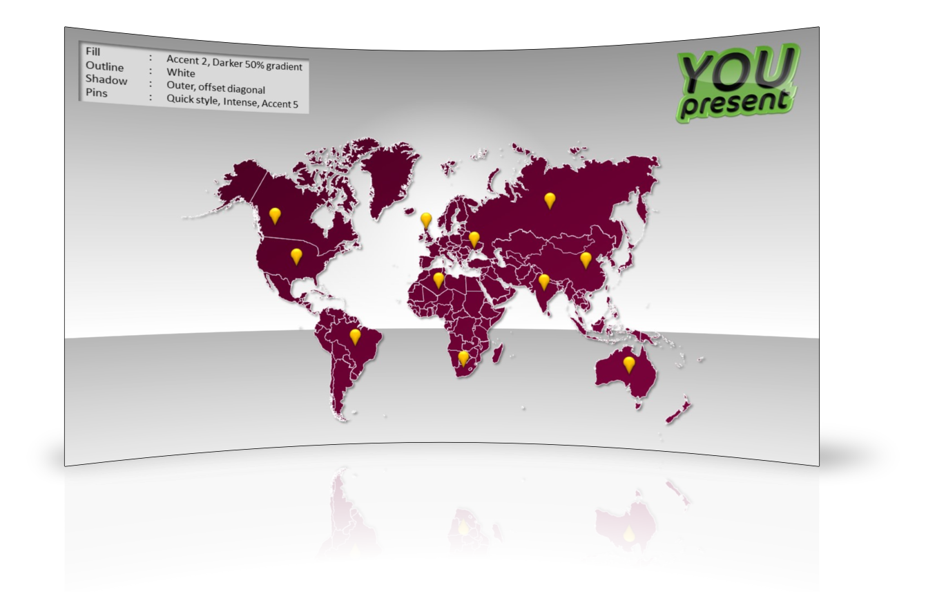
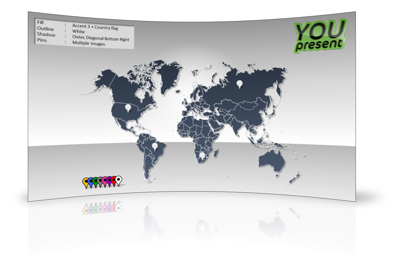
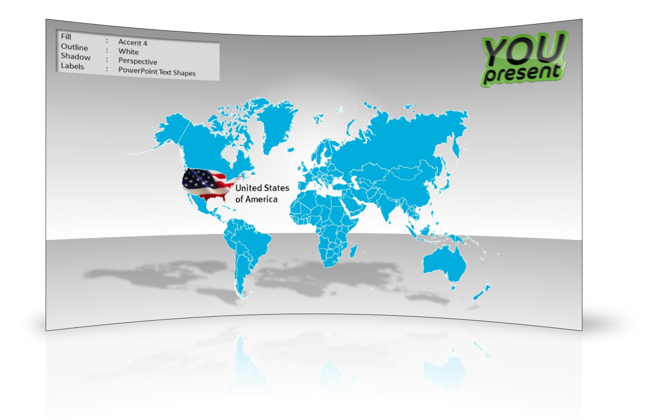
Editable PowerPoint MapsThese maps are designed in PowerPoint, for PowerPoint. Insert them directly from the slide template and:
The sequence shown here demonstrates just a few of the infinite possibilities. And because all of the countries are PowerPoint shapes, you can even animate them to appear in a certain sequence of make them appear on the click of other objects on your slides. |
       |
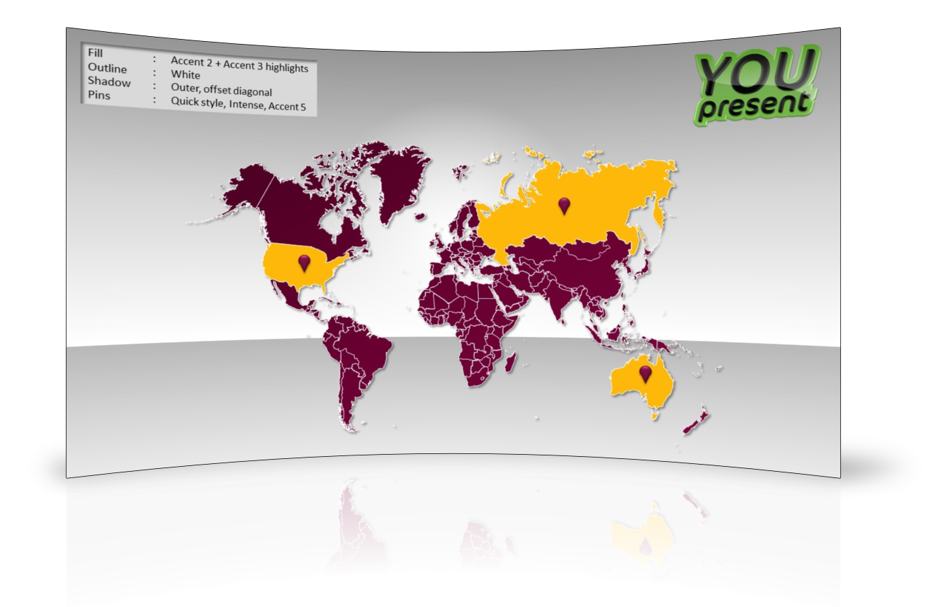
Interactive
 This map is delivered as a set of 9 slides, each containing active buttons that enable you to highlight a particular country. This may be retained, removed or enhanced using the standard PowerPoint animation features. Use the iDemo to interact with an on-line flash conversion of the actual PowerPoint slide show.
Why Buy Our Maps?
Because your maps can now be engaging as well as informative, all for a lower price than other alternatives. With an interactive map, you or your audience can click on country buttons to highlight the location of the country and with the built in editing features of PowerPoint, you can extend the map to add the data and images you need for your presentation. Edit, recolor, resize, fill with textures and images, change text, hide countries, increase/decrease interactivity and much more. Use them for regular business presentations, touch screen displays, multimedia kiosks, education and more.
Compare Our Map Solutions
Templates | vMaps add-in | MapPrez add-in
| Best for | Occasional maps without needing to install software | Access to thousands of editable vector shape maps from a single button in the ribbon | Plotting points on detailed maps using Google Maps service |
| Installs into PowerPoint ribbon | no | yes | yes |
| Fully Editable Maps & Labels | yes | yes | Google Maps are not editable but vector shapes in are provided for selected geographical zones in the full version |
| Free Updates | no | yes | N/A |
| Auto Color (via Excel Data) | no | yes | no |
| PowerPoint Compatibility | PowerPoint 2013 | PowerPoint 2013 | PowerPoint 2013 |
| PowerPoint 2010 | PowerPoint 2010 | PowerPoint 2010 | |
| PowerPoint 2007 | PowerPoint 2007 | PowerPoint 2007 | |
| PowerPoint 2003 | |||
| PowerPoint:mac 2011 | |||
| Free Version | no | no | yes |
| Price | $79-$149 | $149 | $199 |
| Choose Solution | more » | more » | more » |