Editable Maps and Heat Maps for PowerPoint
Insert a map from a library of thousands or create visual information with heat maps
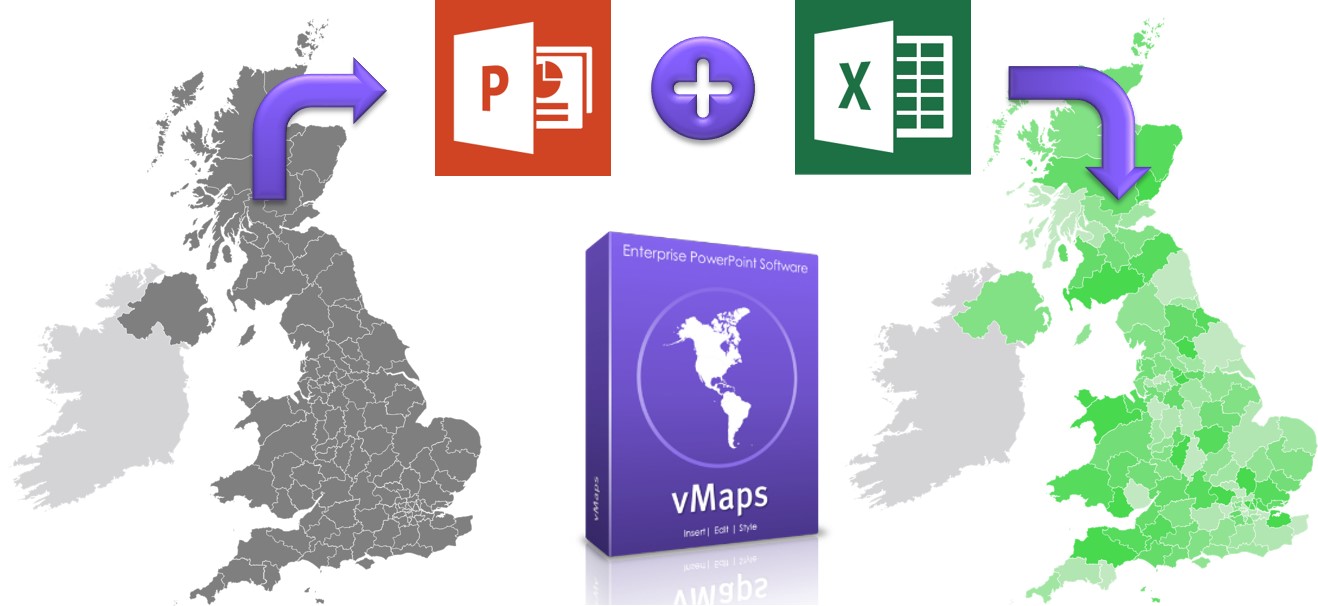
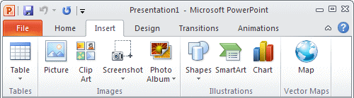
Easily insert and edit maps into your PowerPoint slides and optionally recolor them with Excel data to create visually compelling heat maps. vMaps adds a new button to your PowerPoint ribbon which gives you access to more than 3000 vector drawn maps at a single click which can be edited, styled and animated as you need.
Editable PowerPoint Maps
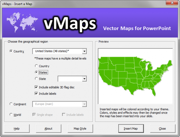
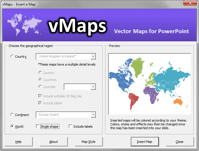
These maps are designed in PowerPoint, for PowerPoint users. Find the map you want quickly from a library of more than 3000 maps, then insert them directly into your slide and:
- Edit, delete and add place names
- Edit map colors, outlines, fills and effects
- Animate place names and countries
- Resize maps without loss of resolution
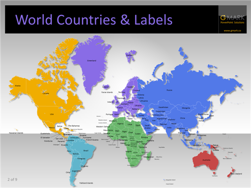
- Selectable continents and countries in the World map
The sequence shown here demonstrates just a few of the infinite possibilities:

Easy Access
Multiple Maps and Styles
- More than 250 country maps (full list)
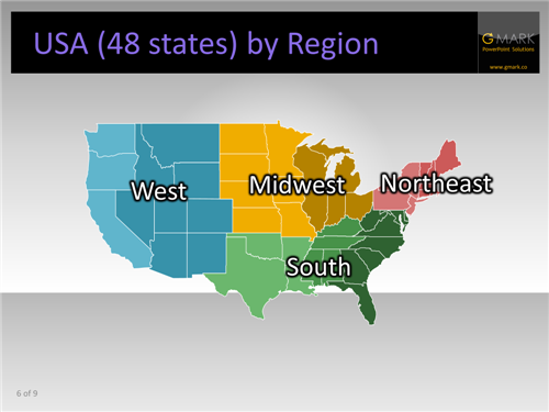
- More than 3000 USA county maps, available by state
- Select by geography: Country, Continent, World
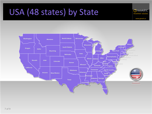
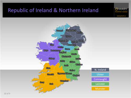
- Insert country sub-areas eg. States for USA or Counties for Ireland
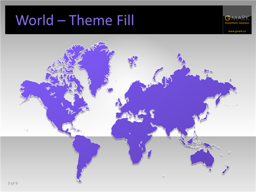
- Paint styles from existing slide shapes
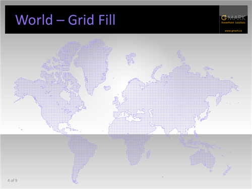
- Fill maps with grid a theme based pattern
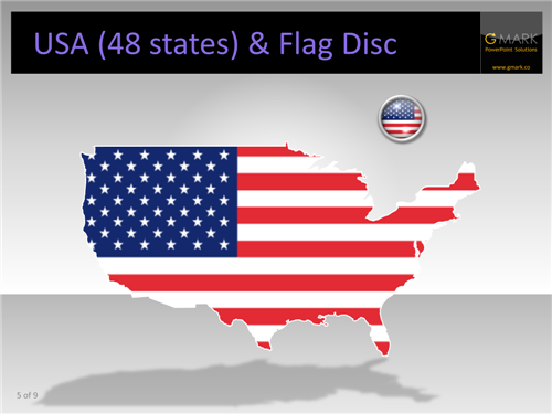
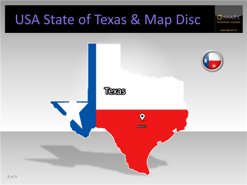
- Insert 3D flag discs and fill maps with flags
- Include labels for selected maps
- Insert maps in to placeholders
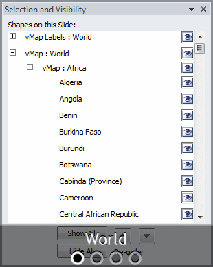
Easy Selection
- Select a single object
- Select multiple objects (with Ctrl key)
- Hide and Show objects
- See your selection on the slide
*To enable the selection pane, press Alt+F10 in PowerPoint 2013 or 2010 and in 2007, click Home in the PowerPoint ribbon and then from the Editing group on the far right of the ribbon, click Select followed by Selection Pane.
Heat Maps using Excel
- RGB (Red, Green, Blue) values set in your Excel file
- Data Scale – a data value is defined in your Excel file plus two colors representing the minimum and maximum values of your scale. vMaps Heatmap then calculates the color for you for each part of the map, based on your data.
Using the Heatmap feature, it’s possible to set the color of more than 200 shapes in the World map in around 60 seconds, a task that previously took hours to complete. The Heatmap feature also supports data import into the text labels on your slide.
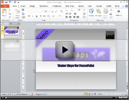
Watch the video to see how easy it is to color your maps based on either Demo to discover how easy it is to use vMaps.
Watch a Flash Demo
Supported Maps
Please refer to the current full list of maps that are included with vMaps before purchasing. We add new maps on a regular basis which licensees receive for free. If you would like us to consider adding a specific map, please contact us.
Why Buy vMaps?
By choosing YOUpresent for your maps, you benefit from the following:
- Low Price : get thousands of maps for the price you pay for a single map from other suppliers
- Integrated : Because vMaps appears in your PowerPoint ribbon, you never have to search presentations to find the map you want
- Named Shapes : All of our maps are designed for PowerPoint and each slide object is named so that you can find it easily in the PowerPoint Selection Pane
- Vector : Our maps are drawn as vectors which means that as you enlarge or reduce them, the edges stay 100% crystal clear
- Editable : Edit, recolor, resize, fill with textures and images, change text, hide countries, add animation and interactivity
- Use and Distribute : Our license terms allow you to add maps to your slides and then freely distribute them (as long as you are not reselling them). Use them for regular business presentations, touch screen displays, multimedia kiosks, education and more.
- Free Updates : As we improve our products, you benefit from a lifetime license offering free updates
- Support : Should you need to contact us, we offer real human support by phone or email
Compatibility
Versions of PowerPoint (PC) and Windows
Compare Our Map Solutions
Templates | vMaps add-in | MapPrez add-in
| Best for | Occasional maps without needing to install software | Access to thousands of editable vector shape maps from a single button in the ribbon |
| Installs into PowerPoint ribbon | no | yes |
| Fully Editable Maps & Labels | yes | yes |
| Free Updates | no | yes |
| Auto Color (via Excel Data) | no | yes |
| PowerPoint Compatibility | PowerPoint 2013 | PowerPoint 2013 |
| PowerPoint 2010 | PowerPoint 2010 | |
| PowerPoint 2007 | PowerPoint 2007 | |
| PowerPoint 2003 | ||
| PowerPoint:mac 2011 | ||
| Free Version | no | no |
| Price | $79-$149 | $149 |
| Choose Solution | more » | more » |
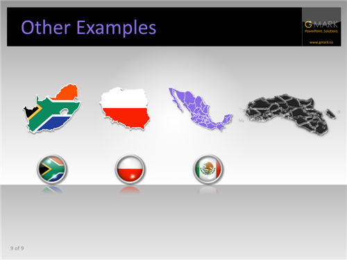
 Example Maps