vMaps Support
editable maps for PowerPointChange History

Version 2.57 - 29 June 2015
All customers should upgrade to this version as our update server is moving.
Build : 29JUN2015 15:28
New Features:
- Added new World Outline Miller projection map (no labels) and corrected reference to Robinson projection
Changes:
- Updated all help, support & update URLs and email addresses to the new youpresent.co.uk domain.
- Now detecting when no slide is selected (cursor between slide thumbnails) when Insert Map is clicked.
Bug Fixes:
- Fixed color palettes not always getting correctly setup when loading the Style window.
- Corrected an issue that caused the error “Nothing appropriate is currently selected.” to be displayed when using grid fill.
- Corrected an omission that prevented the user’s preference for Grid Color from being saved in Style form
- Include Counties checkbox was not being disabled when Country deselected
- Corrected a PC speed variation issue which could cause an “Empty Clipboard” error when inserting complex maps.
Version 2.56 - 19 November 2014
Note : Existing customers do not need to install this version.
Build : 19NOV2014 12:01 (includes unpublished 2.55)
New Features:
- Brand new extended trial mode:
- offers potential customers with access to all maps and associated formatting features for evaluation,
- the Heatmap feature now allows the World map to be used to evaluate this feature in trial mode,
- the restriction is that maps may not be copied or saved without purchasing a license.
- License rescind mechanism added.
Version 2.54 - 13 October 2014
Build : 13OCT2014 11:52
New Features:
- Make selecting RGB/HSL mode easier with colour scale graphics
- Modified transparency so it can be set in the parent form
Version 2.53 - October 2014
Build : OCT2014
New Features:
- Heatmap Feature : Add background colour option
Changes:
- Update/add new ribbon images in first run window
- Corrected LongPtr type mismatch in Excel x64
- Reworked ribbon signatures inVBA & XML to make them unique from other GMARK add-ins
- Removed the UI14 definition in XML (and removed auto scale to prevent the map button from shrinking)
- Removed the Options from the Heatmap Template ribbon action and moved the functionality to an external sub
- Modified Options window for ease of use
- Moved flag to top right corner of slide (regardless of slide size)
- Fixed issue with the ribbon not appearing in 2007
Version 2.52 - 09 October 2014
Build : 09OCT2014 18:22
New Features:
- Added a Miller projection to the World map series, with a corresponding update to the Excel template file
Changes:
- Renamed the “Auto Color” feature to “Heatmap”
- Reworked the ribbon group to make using the key feature of vMaps easier
- Added enhanced error reporting
- Updated support URLs
- Inserted maps are now resized to fit 80% of the slide (regardless of the slide dimensions) and are centre
Version 2.51 - 07 October 2014
Build : 07OCT2014 00:15
New Features:
- Beefed up Excel file validation for Auto Color
- Auto refresh the sheets combo when the Excel file name is changed
Changes:
- Close the Excel file when not in use (only open to refresh the Sheets combo and the Colour the map)
- Improve the scale formatting based on the source data
- Made the first run splash screen more intuitive
- Made the AutoColor status clearer
- Removed the “vMap :” shape name check for Set Outline to Fill
- Prevent Auto Color and Get Group Names features when there is no presentation open
Bug Fixes:
- Fixed an issue that allowed a have range controls to remain visible when RGB mode selected after refreshing sheet names on opening Auto Color in RGB mode
- Fixed an issue that prevented subsequent Auto Color operations from working correctly after the user terminated the process with the Stop button.
- Fixed the issue that the Set Outline to Fill feature to run on multiple maps on the same slide.
Version 2.5 - 01 October 2014
Build : 01OCT2014 15:54
New Features:
- Added Auto Color option to create a graphical scale key on the left of the slide. The scale is made from standard PowerPoint shapes and text boxes so is fully editable.
Version 2.4 - 30 September 2014
Build : 30SEP2014 16:43
New Features:
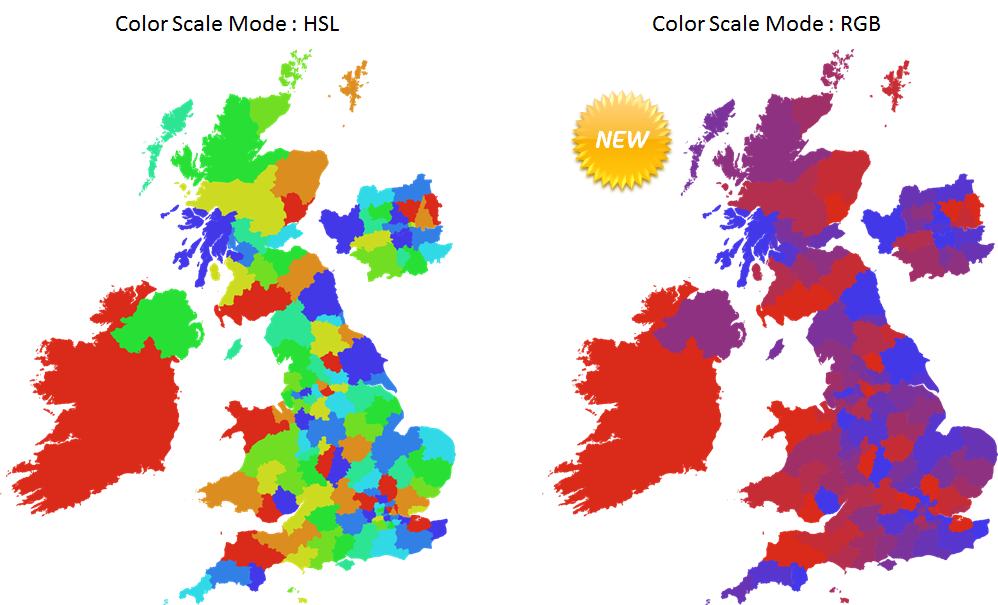
- Added Auto Color option to create the color scale using one of two modes, RGB or HSL. This is useful for creating a more natural “heatmap” when the minimum and maximum colors that are set use vastly different hues e.g. red and blue.

Version 2.3 - 30 September 2014
Build : 30SEP2014 14:05
New Features:
- Added Auto Color option to set the outline colour to the same used for the fill (produces better visual result)
- Added Auto Color option to replace the text in labels with values from the Excel file
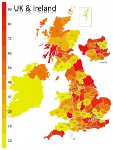
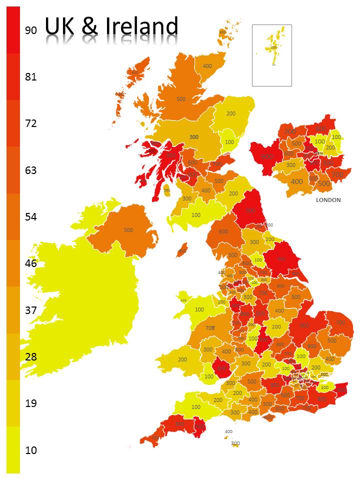
- Added a new map for “UK Postcode Areas”
- Updated the Excel template file for the above new map and new label text feature.
Changes:
- Enhanced Auto Color to ensure that Excel instances are always closed
- Enhanced Auto Color to ensure that shape fills are always visible
- Enhanced Auto Color user feedback messages
- Enhanced Auto Color so that it’s not necessary to preselect the vMap group prior to using Auto Color
Version 2.2 - 19 September 2014
Build : 19SEP2014 12:44
New Features:
- None.
Changes:
- Corrected an issue that prevented AutoColor from working with non-freeform shapes.
- Corrected an issue that caused the AutoColor counter, that records the number of recoloured shapes, from incorrectly counting matched but not re-coloured shapes.
Version 2.1 - 28 July 2014
Build : 28JUL2014 14:36
Size : 33.3 MB (ZIP is 34,957,687 bytes)
New Features:
- The PowerPoint Selection Pane is now automatically activated and width scaled to the named slide content when a map is inserted and a help tip message is displayed.
- The map group (layer) is now automatically selected when a map is inserted to aid the use of the Auto Color feature.
- If numerous map elements are not found in an Auto Color operation, the user is asked if vMaps should try to select the map group (layer).
Changes:
- Corrected an issue that prevented vMaps from working in 64 bit versions of PowerPoint 2013.
Version 2.0 - 24 February 2014
Build : 24FEB2014 20:46
Size : 33.4 MB (ZIP is 35,043,283 bytes)
New Features:
- Added support to be able to add maps to slide masters and custom layouts.
Changes:
- Reset the default visibility for the USA 48 States map labels layer.
Note : a 2.0bis version added a digital certificate to the installer as the only change (35,078,651MB) on 30APR2014
Version 1.9 - 14 January 2014
Build : 14JAN2014 11:50
Size : 33.3 MB (ZIP is 34,936,586 bytes)
New Features:
- Added new region level maps for China, India, Indonesia, Malaysia, Myanmar, Sri Lanka, Vietnam.
Changes:
- Corrected the support email address used to report an error and modified/corrected several data items.
Version 1.8 - 26 November 2013
Build : 26NOV2013 11:21
Size : 33.2 MB (ZIP is 34,901,892 bytes)
New Features:
- Added new region level map for Germany and updated the Auto Color template file in Excel accordingly (download from the vMaps group in PowerPoint).
Changes:
- Internal only : Version number picked up from installer.
- Add-In registers itself when loaded (in case Windows registry settings failed during setup).
Bug Fixes:
- Fixed a naming issue with the Australian state level map which prevented it from being inserted.
Version 1.7 - 18 November 2013
Build : 18NOV2013 16:12
Size : 33.1 MB (ZIP is 34,719,007 bytes)
New Features:
- vMaps is now available in French (installer, ribbon and key windows have been translated plus a new French web page).
- Added the following new maps:
- Regional maps for : Denmark, Norway, Sweden, Finland, France (and updated the Auto Colour template Excel file)
Changes:
- Changed the default behaviour of Auto Update to off (users must turn it on if they want vMaps to automatically check if updates are available).
- When Auto Updates are on, a visual indicator is presented to show that vMaps is check the server when PowerPoint starts.
- Changed Internet connection detection method from ICS to Ping (used for Auto Updates).
Bug Fixes:
- Fixed an issue whereby all/main European country selection logic was reversed.
- Fixed a number of issues with the color selection window (used with Auto Color).
Version 1.6bis - 17 June 2013
Build : 2013.06.17.1
Size : 32.1 MB (ZIP is 32,552,828 bytes)
New Features:
- None.
Bug Fixes:
- Corrected an issue with the Auto Update feature whereby it always reported that a new version was available, even if the product was up to date, for locales that use a comma to decimalise numbers.
Version 1.6 - 26 September 2013
Build : 2013.09.26.1
Size : 31.8 MB (ZIP is 33,435,397 bytes)
New Features:
- None.
Bug Fixes:
- Corrected an issue with the Auto Color feature whereby the error “Compile error in hidden module: frmSelectColor” occured when clicking on one of the two color swatches in the Auto Color window when using PowerPoint 2007.
”Version
Size : 32.1 MB (ZIP is 32,460,984 bytes)
New Features:
- None.
Bug Fixes:
- Corrected an issue with the Auto Update feature whereby it incorrectly stored the user state of the feature, preventing it from being disabled and therefore prompting the user that an update was available every time PowerPoint started. It also checks for updates more intelligently now.
- Corrected a ribbon error that prevented the vMaps group from appearing in PowerPoint 2007, hence the product was not accessible.
”Version
Size : 32.1 MB (ZIP is 32,387,072 bytes)
New Features:
- Auto Color now has stronger Excel file validation and checks that RGB cells are within the 0-255 range, are integer and are not text. Any errors are automatically corrected (non-integer values are rounded, values higher than 255 are set to 255 and everything else is set to 0).
Bug Fixes:
- Corrected an error which caused maps to be colored with incorrectly calculated colors when the RGB mode was used.
”Version
Size : 32.1 MB (ZIP is 33,673,808 bytes)
New Features:
- Map library now includes the African countries of Sudan, South Sudan and Malawi.
- New Australia outline map in Mercator projection.
- New Australia States map with state and major city labels.
- Auto Color Excel template updated with changes for Africa and new sheets for Ireland.
- New trial functionality to enable evaluation of Auto Color feature.
- Licensing for double-byte languages.
- Auto check for updates when PowerPoint starts (with user override).
- Trial reminder appears when PowerPoint starts.
- Map window unloads after a map has been inserted.
Bug Fixes:
- USA states (48) map error fixed for the states of New Jersey / New York.
- Tasmania now part of the Australia grouping.
- Bug fixed whereby incorrect map name text could be added to slide.
- Compatibility issues with PowerPoint x64 (2010 & 2013 on Win 7/8 x64) have been fixed.
- Corrected a bug that caused the add-in to crash when trying to fill shape groups that contain non-freeform shapes.
- Auto Color now works if map is filled with a picture (e.g. a flag) before Auto Color starts.
Known Issues:
- Error handler report screen appears in some places when it should not.
Outstanding Map & Feature Requests:
- LATAM map (note: all maps exist and this is a request for a specific grouping).
- Indonesia states map.
- PowerPoint 2003 support (this has now been rejected due to technical incompatibilities in the Microsoft engine).
”Version
Size : 32.4 MB (ZIP is 34,041,186 bytes)
New Features:
- Added Canada Provinces map and updated Auto Color sheet accordingly.
- Added error reporting so that users can easily report issues and configuration details if a problem occurs.
- Changed ‘About’ to ‘About and License’ in the ribbon button.
Bug Fixes:
- Corrected the installer so that the add-in is now aware if the user changes the default installation folder (previously, this caused the add-in to fail and display the message “It appears you have registered your vMaps license but have not installed the full version of the addin.”).
- Removed a reference to MSCOMCTL.OCX which caused a compiler error on some configurations to display the message “Can’t find project or library”.
- Corrected the error handler so that the confirmation of a map being added to the slide is not shown when this is not the case.
- Changed procedure and variable declarations to be Office x64 compliant.
Size : 32.0 MB (ZIP is 33,628,303 bytes)
New Features:
- Changed the vMaps button to a split type in the Insert tab of the PowerPoint ribbon.
- Added more than 3000 new maps (including FIPS codes in names) at county level for the United States of America.
- Added new Auto Color feature.
- First release of Auto Color Excel template.
- Various changes to library maps to make them compatible with Auto Color (mainly combining shapes to remove ‘Freeform xyz’ shapes).
- Added PowerPoint 2013 support.
- Added a message to show when a map has been added (for small screen displays that cannot see the map under the vMaps window).
Bug Fixes:
- Fixed the broken link in Windows Start / Programs / vMaps / Run vMaps in PowerPoint.
- Fixed an issue that caused the USA states to be loaded twice in the drop down selection box.
- Fixed some map selection logic.
- Fixed a cache issue that prevented the Software Updates feature from working (and added the feature to the split button menu).
- Fixed several map data issues (e.g. USA Louisiana state flag wasn’t working).
”Version
Size : 26.8 MB
- Added new maps at county/region level for the United Kingdom and Republic of Ireland.
”Version
Size : 17.9 MB
- First commercial release of vMaps.